Use Cases
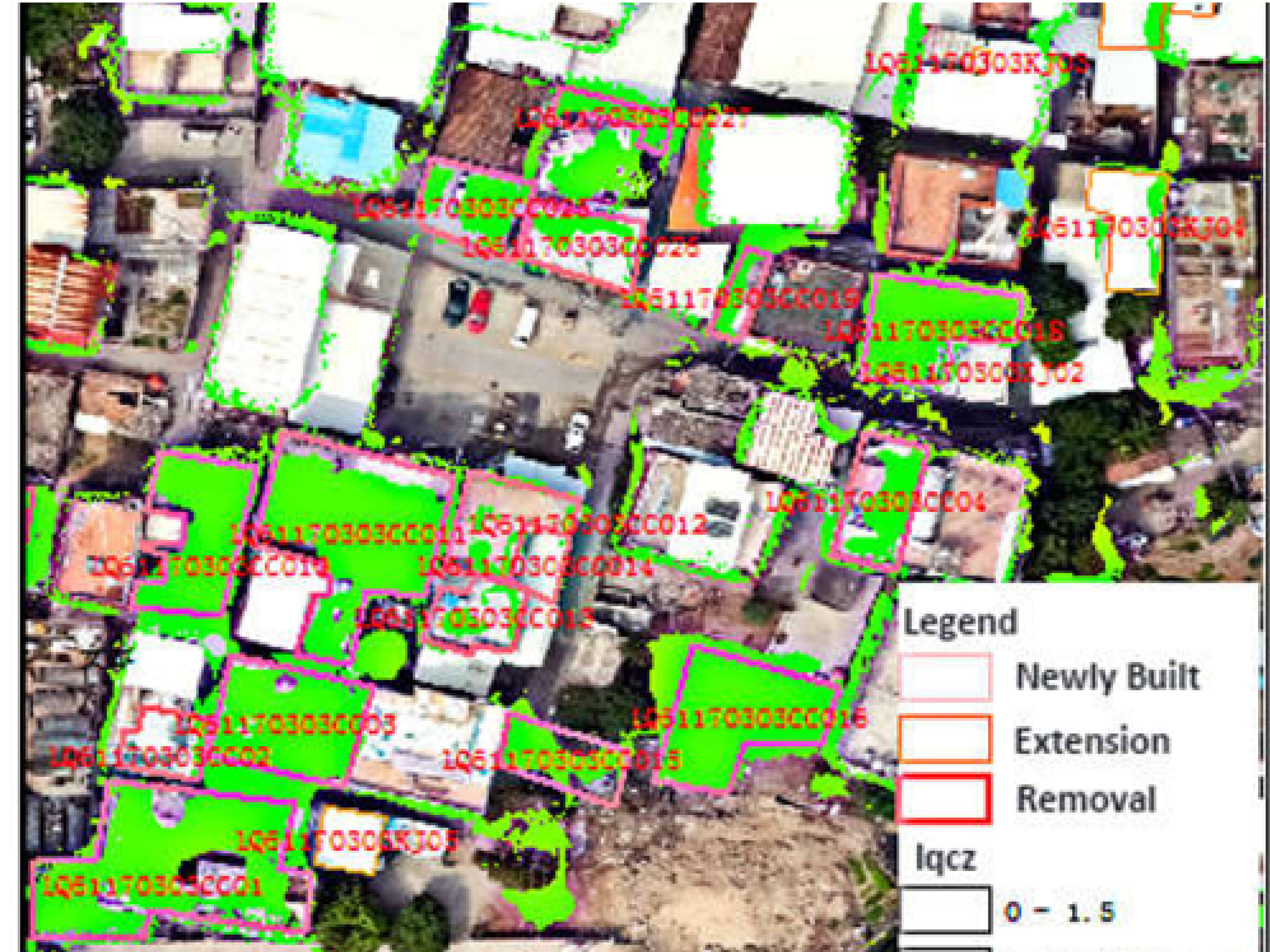
Finding Illegal construction and collecting revenue (3D)
Photogrammetric Solution
- Capturing of building outline and boundary features such as fence, walls, and gates.
- Demarking boundary outline or property outline. Parcel mapping of vegetation areas.
- Areas served: Dubai, Abu Dhabi.
Route Planning and Logistics
Routing and logistics package for municipal trash collection
- The waste application allows you to define a general area for waste collection, using standard geographical data.
- The GIS calculates new, highly efficient, and realistic collection rounds to the service area.
- Maps available transfer stations/landfills for each tip trip and the resources available, in terms of vehicles, crews, and their working hours.
- The GIS performs an analysis on how to reduce the number of rounds, or it can optimize existing rounds whilst maximizing the productivity of each vehicle.

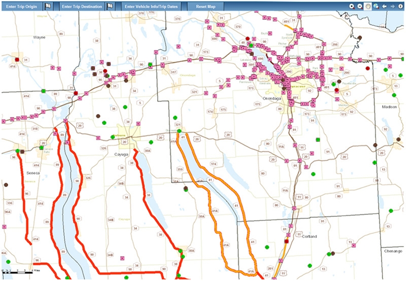
Highway Plan for Federal Highway Administration
- New York State DOT’s Oversize/Overweight Pre-Screening Tool
- Bridge and Road Restrictions
- Height restriction data
- Vehicle dimension entry form
3D City Model
- Capturing of building outline and rooflines using the stereo model.
- Each roof having an elevation difference of more than 1 meter is separately captured with a centroid.
- This is used for the creation of a 3D city model of buildings.
- Topographic mapping is also carried out for analyzing the surface.
Areas served: Melbourne, Sydney, Capetown, Warsaw, and Colorado

Demarcation of Airport Features
Photogrammetric Solution
- Detail planimetric features such as Runways, Apron, Taxiways, traffic control signals, and other features are captured.
- Client served: Abu Dhabi Civil Aviation.

Topographic Details for Troop Movement
Photogrammetric Solution
- Detailed topographic feature capturing along with some planimetric features such as rivers, bridges, roads, tracks, etc.
- These outputs are used for finding the shortest path for troop movement.
- Topographic details are used for safe troop movement.
- Solution served in: Himalayan region.

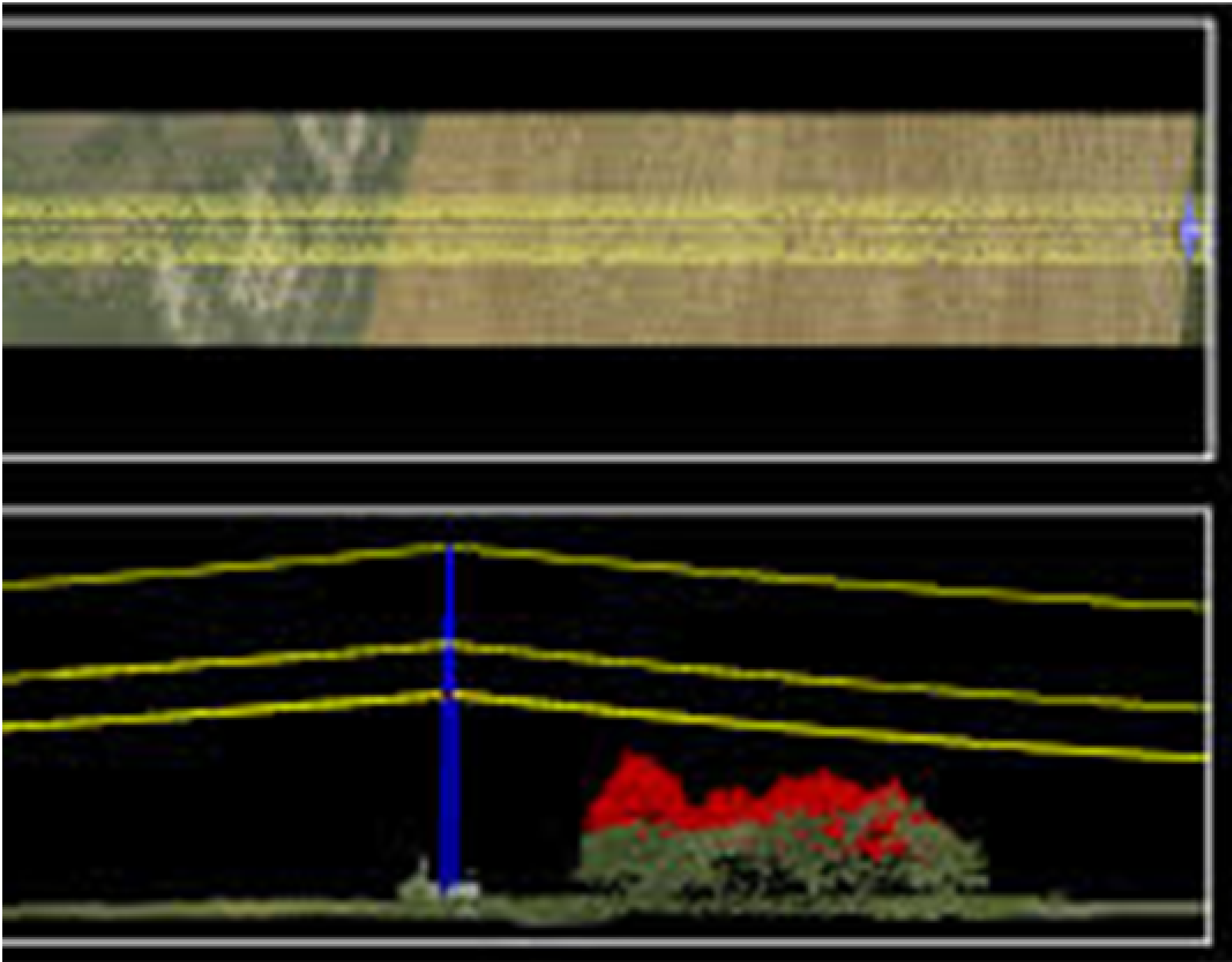
Constructing Roads for Maintenance of High-Tension Powerline
Lidar and Photogrammetric solution
- Demarcation of Pylon and High tension line using lidar cloud points.
- Determination of terrain for laying down roads.
Powerline inspection diagram
Crime Mapping
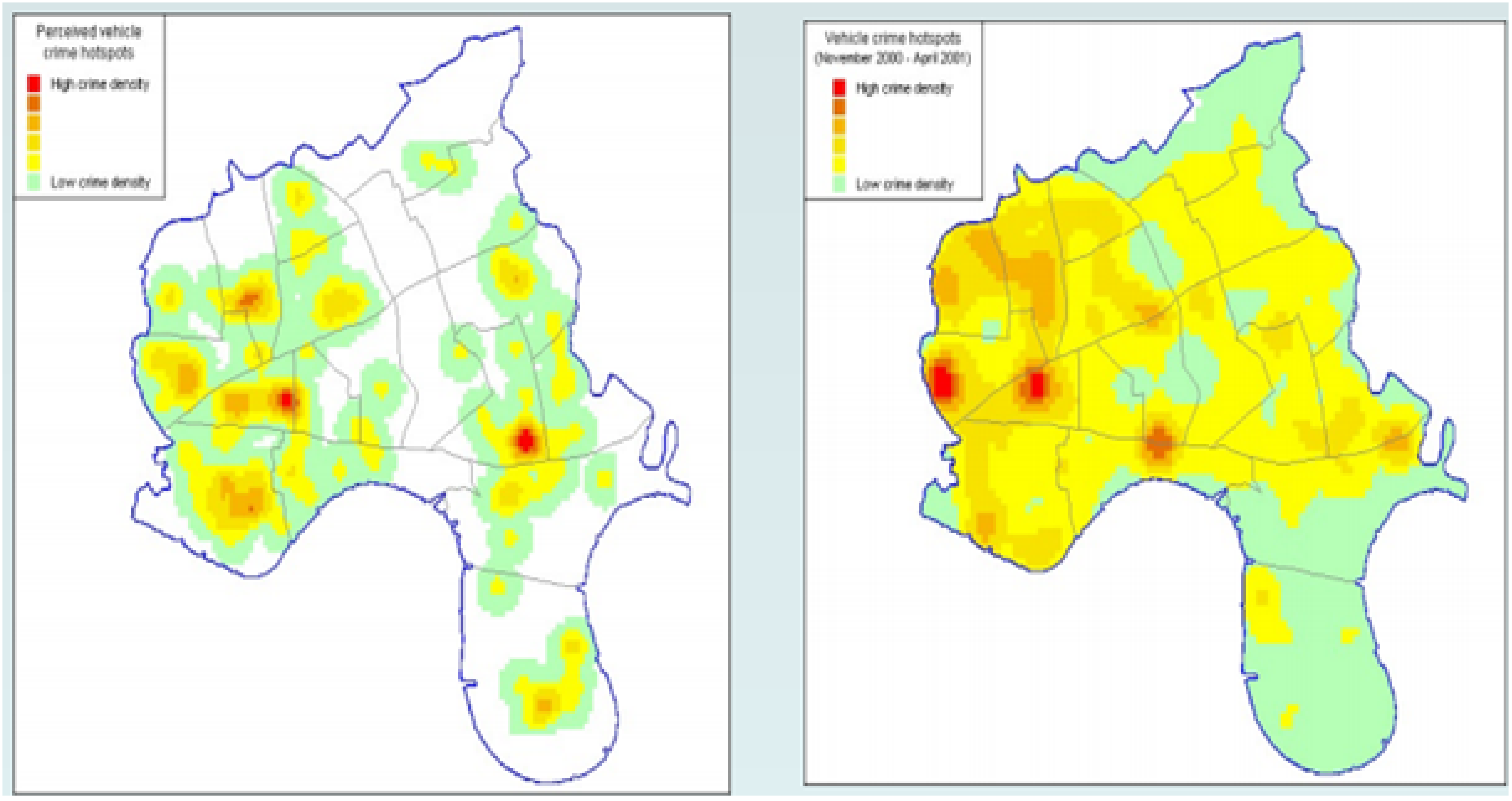
Crime analysis gets easier with crime mapping. Satellite images showcase some important data on criminal activities. Crime-fighting can be easier and in our reach with the efficiency and the speed of the GIS analysis.
Exploits the inherent geographical quality of crime
- Where do offenders live?
- Where are the most vulnerable communities/targets located?
- How do offenders commute to the location of crime?
- Reasons behind crimes being happened in a particular location.
- Where are our emerging problem areas?
Urban sprawl pattern recognition and modeling using GIS
- The urban sprawl over different time periods have specific spatial patterns that need to be systematically mapped, monitored, and accurately assessed from remotely sensed data (satellite data) together with conventional ground data.
- You get a picture of where this type of growth is happening when urban sprawl is mapped, helping identify the environmental and natural resources are at risk due to such sprawls, and to suggest the possible future directions and patterns of sprawling growth.
- The built-up area as an indicator of urban sprawl
- Population Growth and Built-up Area
- Urban Sprawl Modeling
- Predicting the Scenarios of Urban Sprawl
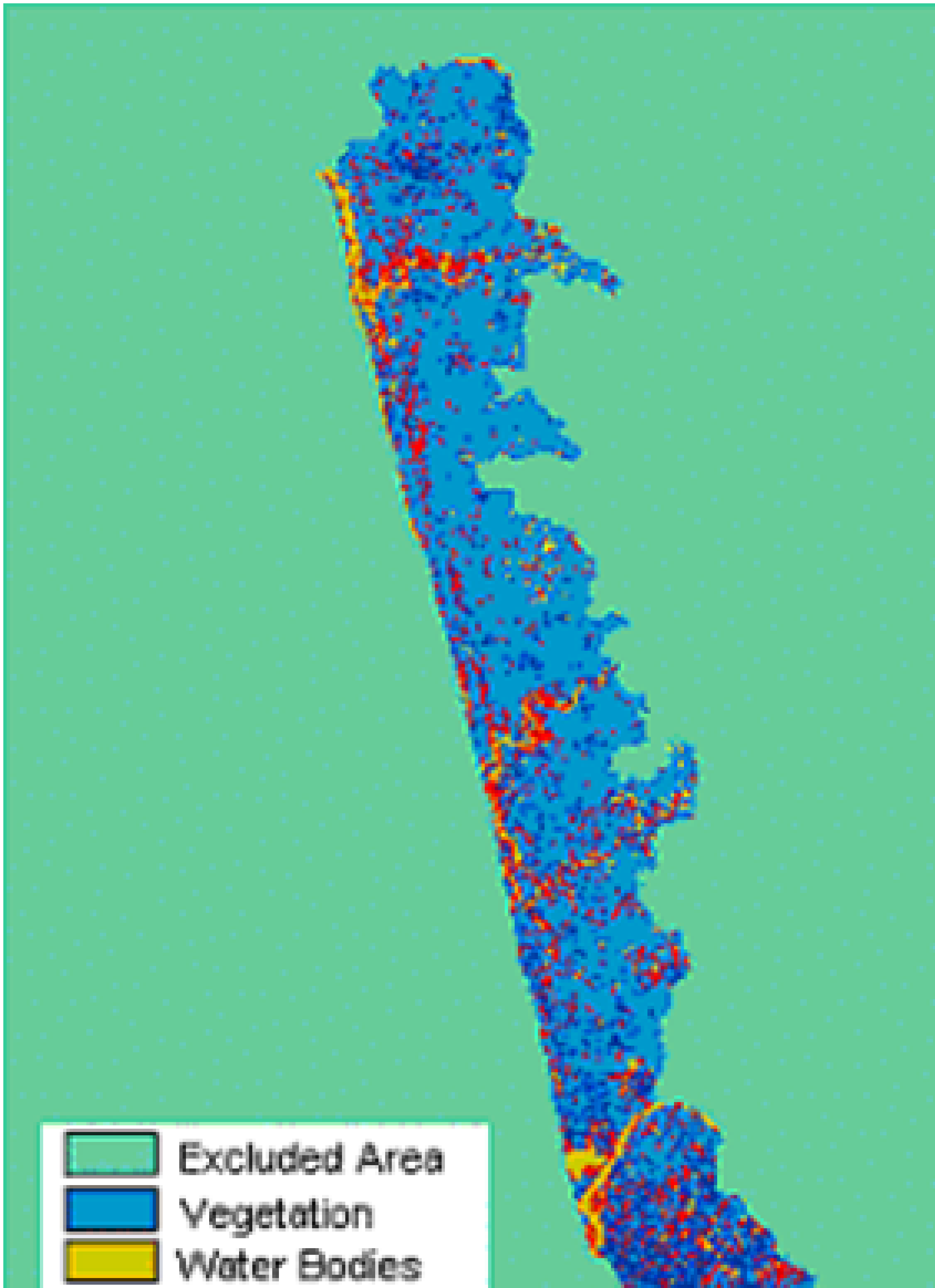
Petroleum Exploration with GIS technology
- GIS has delivered a clear business benefit to the organization where it has been deployed
- Data index maps
- Block ranking
- Land management
- Well planning
- Field operations
- Pipeline routing & monitoring
- Vessel tracking
- Emergency response.

Change Detection
Change detection is a process that observes the differences between an object or phenomenon at different times for the same area. So to understand the improvements in that particular area by means of transportation, residential areas, industrial areas.
When accurate change detection in the Earth’s surface objects or features is provided in time, it then creates a foundation of our better understanding of interactions and the relationships between human and natural phenomena for managing the using the natural resourced in a better way.

Image extraction
Accurately detecting the objects around the road such as trees, traffic lights, and others is an important part of developing autonomous cars.
This concept enables such vehicles to detect traffic lights on their own using the least interaction of humans.

